

BOOKS & CO- FOR THE GROWN UPS
BOOKS & CO - A3 Indigenous Australia Map- Folded
BOOKS & CO - A3 Indigenous Australia Map- Folded
Couldn't load pickup availability
A Cultural Portrait of Language, Country, and Connection
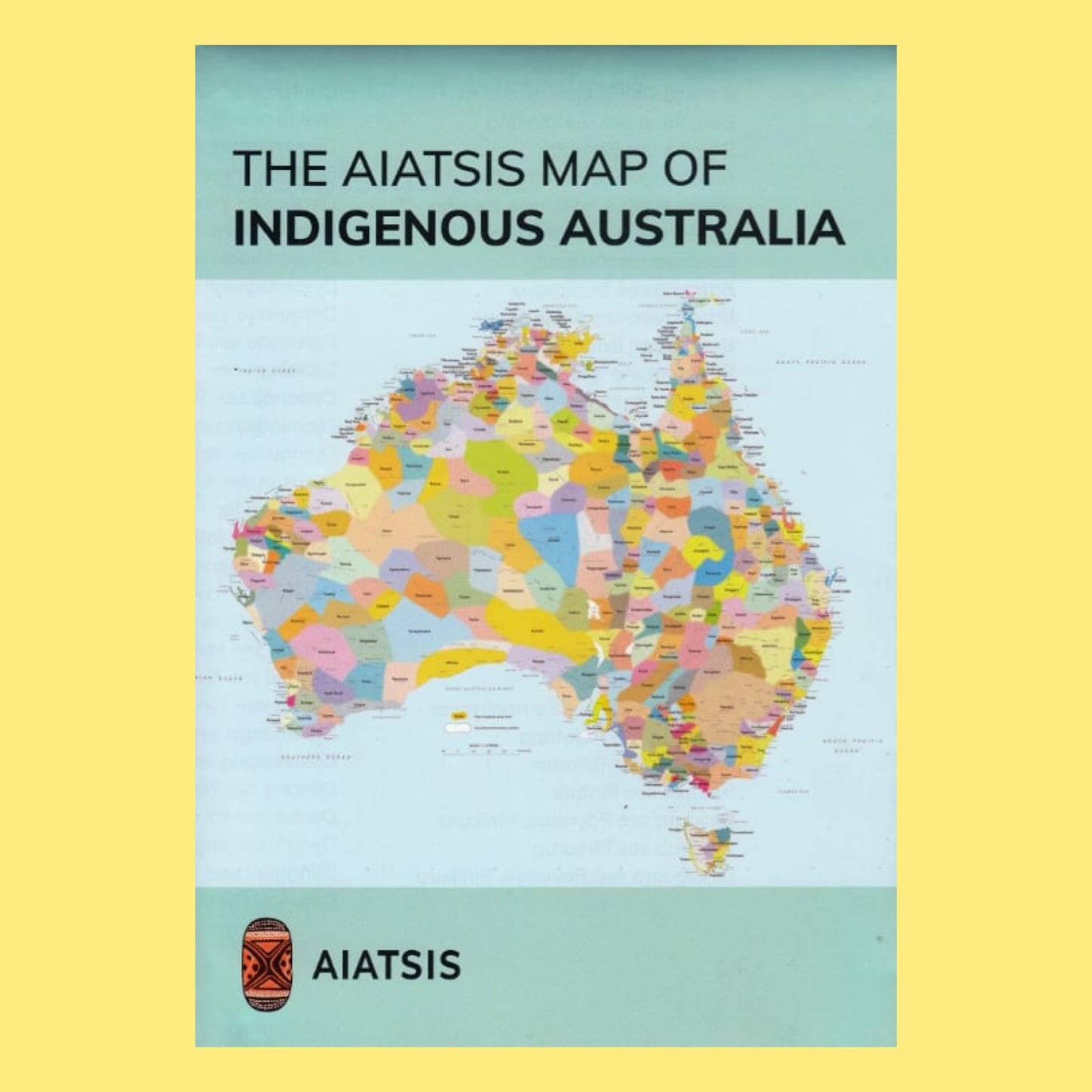
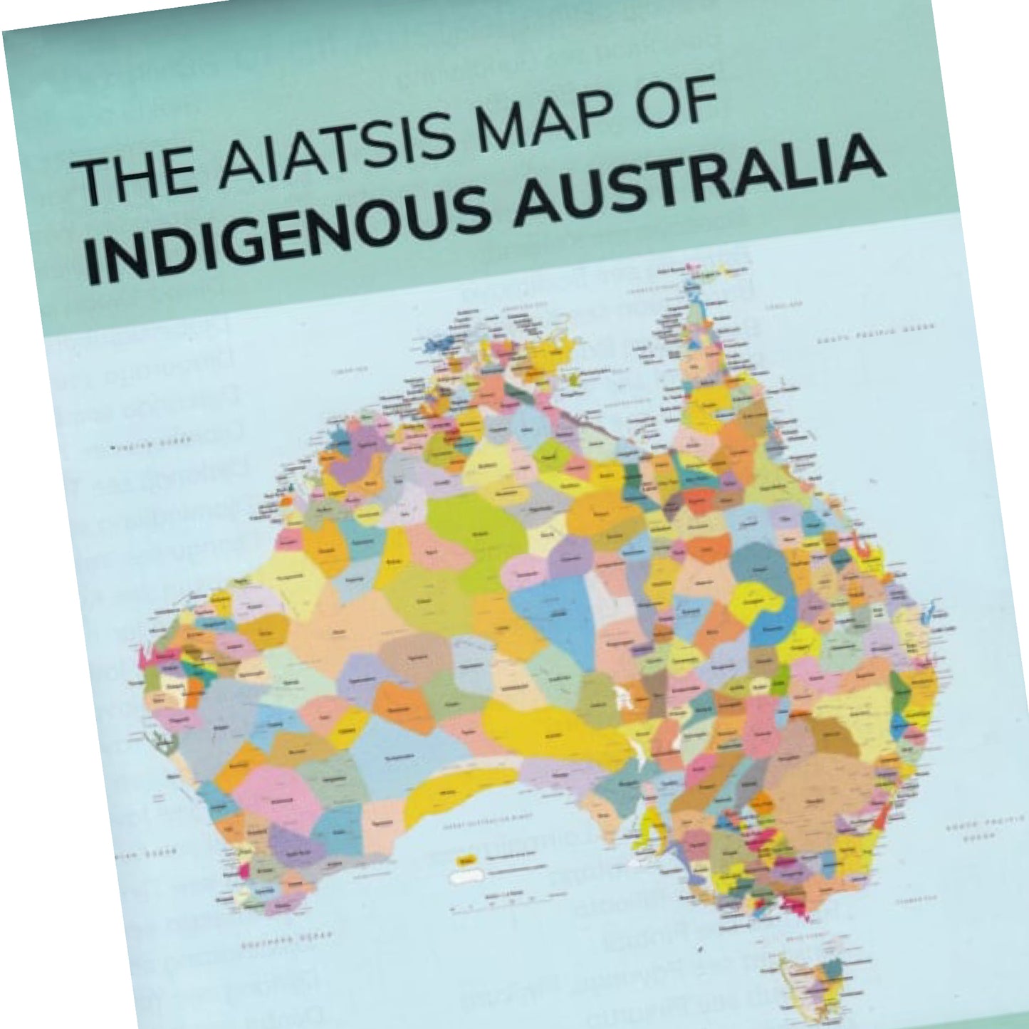
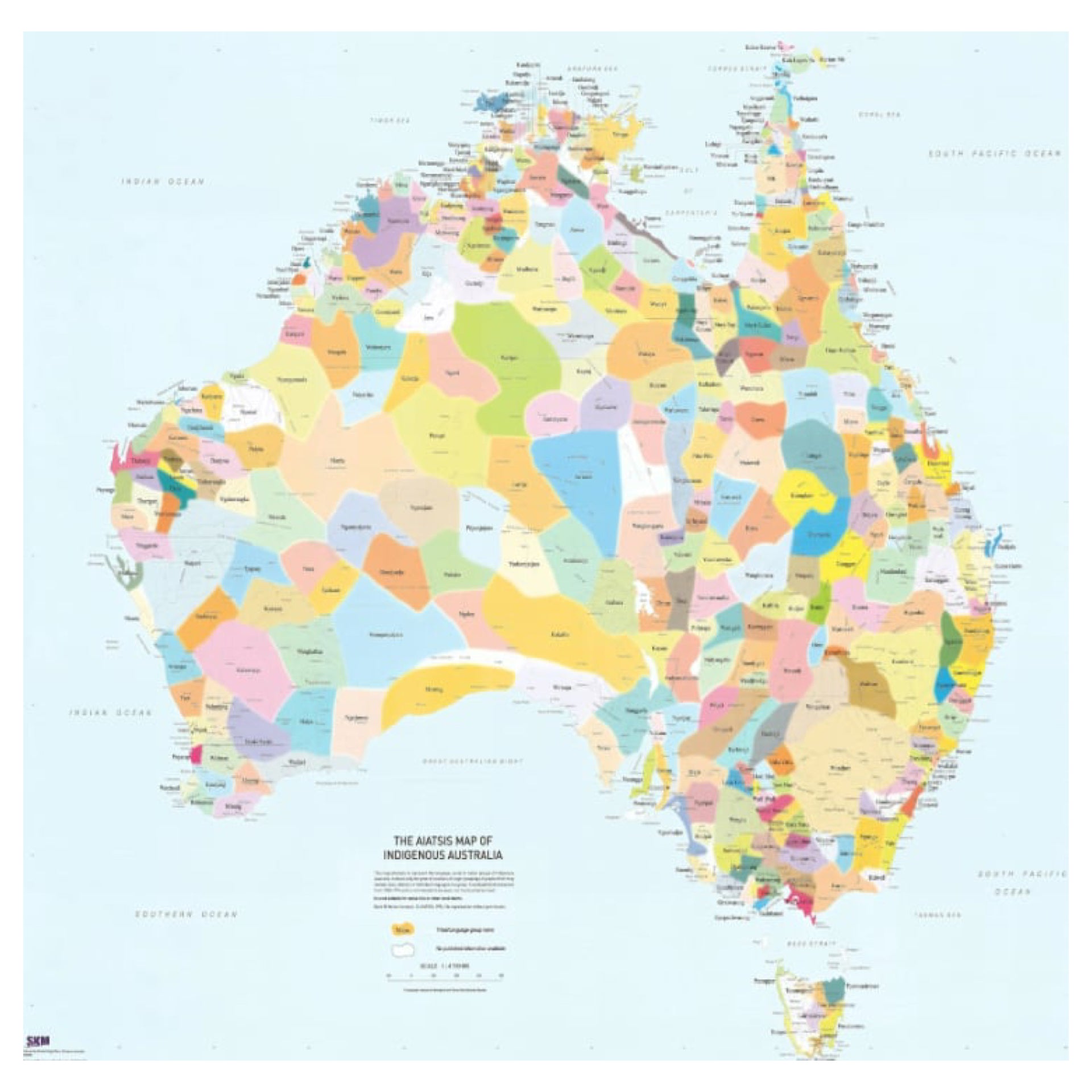
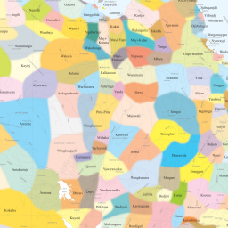
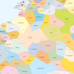
The AIATSIS Map of Indigenous Australia is one of the most respected and widely used visual representations of Aboriginal and Torres Strait Islander peoples across the continent. It highlights the remarkable diversity of over 200 language, tribal, and nation groups, offering a window into the richness and complexity of First Nations cultures.
Originally created in 1996 by David Horton for the Encyclopaedia of Aboriginal Australia, the map is the result of extensive consultation and research conducted between 1988 and 1994. Today, it remains a vital cultural, educational, and visual resource—used in classrooms, universities, homes, workplaces, and public institutions around Australia.
🔍 Important Note: This map illustrates general locations only. Boundaries are not definitive and should not be used for legal, land title, or native title purposes. It is a conceptual map, designed to foster understanding—not define territory.
🗺️ Map Features
-
Cultural Representation: Displays the broad geographic spread of Indigenous groups prior to European colonisation, offering a framework to understand First Nations' connections to land, language, and community.
([Aboriginal Bush Traders][4]) -
Colour-Coded Regions: Each area is uniquely shaded and labelled with traditional names, helping users distinguish one group from another at a glance.
-
Educational Tool: Widely used in schools, libraries, government offices, and cultural organisations to support reconciliation, Indigenous studies, and Australian history curricula.
-
Visual Storytelling: The design encourages inquiry and dialogue, making it a powerful resource for storytelling, research, and classroom discussion.
![]()